The Huts > 10th Mountain Division Hut Association > Peter Estin Hut
Peter Estin Hut
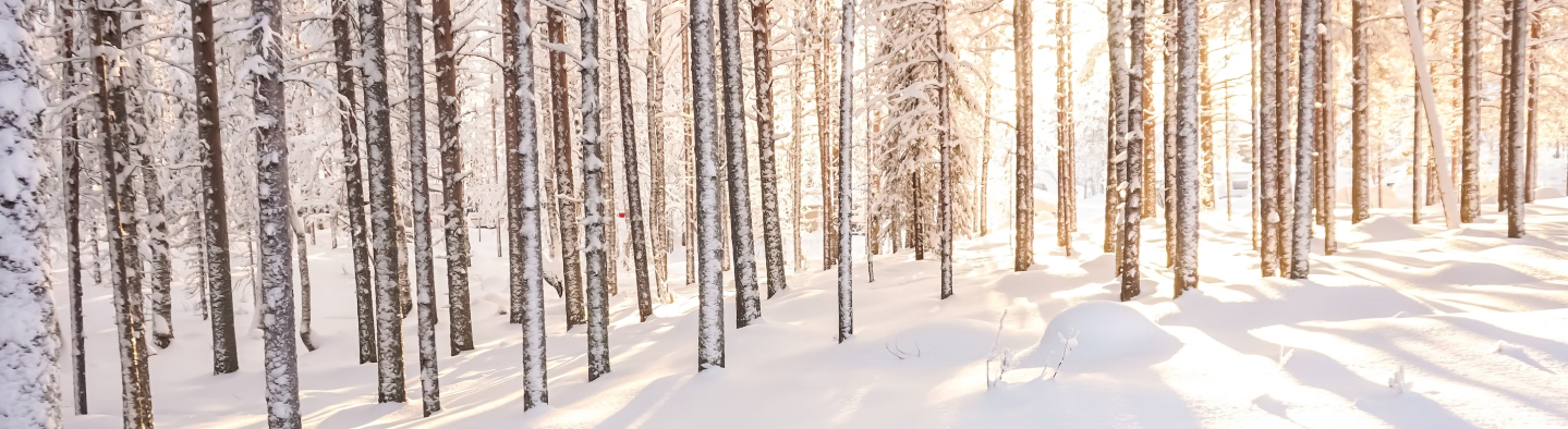
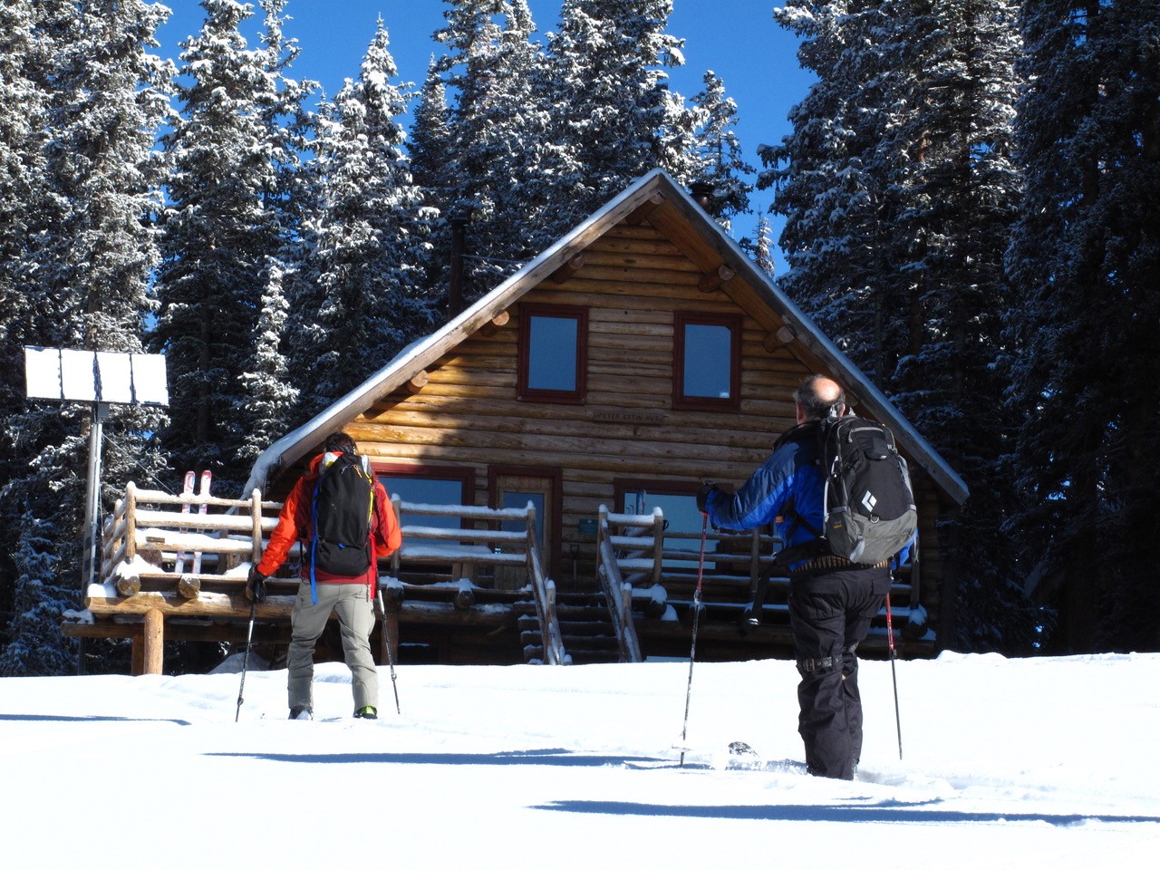
Built in 1985, the Peter Estin Hut was the third publicly funded hut added to the 10th Mountain Division system. This hut represents the “standard” for early 10th Mountain Huts. It stands two stories high, with a commodious deck jutting from the front door. Plenty of glass faces the sunny southern views toward the Elk and Williams Ranges, where a trail descends to Lime Park, making a beautiful connection to the Gates Hut and the Upper Frying Pan Valley. The Estin Hut is also linked by trail north to the Polar Star Hut.
Funds were donated by the Estin family in memory of Peter Estin, who attended Dartmouth College, where he was a member of the ski team from 1944 to 1947. Later, Peter Estin brought his skills to Sugarbush Valley in Warren, Vermont where he was director of the ski school. During summers up north, Peter preferred winters down south where he served as director of the ski school in Portillo, Chile. His dream to start a ski school at Aspen Highlands was beginning to become a reality when Peter died in 1962. In addition to being a beautiful skier, Peter Estin was a cartoonist for the New Yorker and author of “Skiing the American Way.”
Hut Information
Owned By
10th Mountain Division Hut Association
Open
Summer / Winter
Winter Mileage*
4.0
Closest Town
Eagle
Hut Elevation
11,200 '
Cumulative Elevation Gain *
2,156'
Layout
Downstairs: 4 single beds. Upstairs: 2 private bedrooms with one double bed each, plus 8 beds in a communal sleeping area.
*from Yeoman Park Trailhead (Winter)
Amenities
Heat
Wood
Oven
Wood
Refrigeration
No
Water
Cistern, Stream*, Snow Melt**
Toilet
Outhouse
Ada Accessible
No
Sauna
No
Fire Ring
Yes*
Grill
No
Dogs
No
Charging
None
Gear Cart
Yes*
* Summer only
** Winter only
Details
- Firewood, starter paper, matches, axes
- Propane for kitchen burners
- Cupboard or closet for cold food storage
- Snow collection buckets and large pot for melting snow on wood-burning heat stove (suggested use of snowmelt water is for drinking)
- Hand pump located just outside the hut dispenses water from spring-fed cistern (suggested use of cistern water is for drinking if filtered, and cleaning)
- Pots, pans, potholders, dishware, cooking and eating utensils, percolator, salt & pepper
- Paper towels, dish soap, hand sanitizer, cleaning supplies, trash bags, toilet paper
- Solar powered lights
- Mattresses, pillows
Book This Hut
Visit our Online Booking Platform to search for availability and book this hut.
Location
Official 10th Mountain Division Map
CalTopo
Winter Map : Charles Peak N/S Map
View / PrintNational Geographic
Map : Eagles Nest/Holy Cross; Holy Cross/Ruedi Reservoir
USFS
Map : White River National Forest
Trailheads/Routes
The most common route into the Peter Estin hut is via the Ironedge Trail which begins near Yeoman Park. An alternative route is via Hat Creek Road which is longer but less steep. If you are pulling a sled with gear or child, Hat Creek Road is usually the smarter choice.
Routes
Peter Estin Hut from Yeoman Park Trailhead via Ironedge/Standard Winter Route
Total Mileage
4.0
Trailhead Elevation
9,060'
Cumulative Elevation Gain
2,156'
Peter Estin Hut from Yeoman Park Trailhead via Hat Creek Road
Total Mileage
7.1
Trailhead Elevation
9,060'
Cumulative Elevation Gain
2,228'
Peter Estin Hut from Sylvan Lake Trailhead
Total Mileage
9.3
Trailhead Elevation
8,558'
Cumulative Elevation Gain
2,778'
Hut to Hut/Peter Estin Hut to Harry Gates Hut
Total Mileage
7.1
Trailhead Elevation
11,200'
Cumulative Elevation Gain
752'
Cumulative Elevation Loss
2,257'
Hut to Hut/Peter Estin to Polar Star Inn & Seipel Hut via Ironedge and Newcomer Spring
Total Mileage
7.5
Trailhead Elevation
11,200'
Cumulative Elevation Gain
2,123'
Cumulative Elevation Loss
2,266'
Hut to Hut/Peter Estin Hut to Polar Star Inn & Seipel Hut via Hat Creek and Fulford Road
Total Mileage
13.0
Trailhead Elevation
11,200'
Cumulative Elevation Gain
2,203'
Cumulative Elevation Loss
2,349'
In the summertime you can access the Peter Estin Hut by hiking up the Ironedge trail or by driving in from either Sylvan Lake or Yeoman Park to the designated parking area approximately 1/4 mile from the hut. You can also drive in from the Fryingpan River Road on FS 400 and FS 416 but be aware that FS 400 can be very slick and dangerous when wet so watch the weather if you are planning on using it to access the hut. Vehicle access is never guaranteed to any hut at any time.
There are numerous hiking options around the Peter Estin Hut. You can follow the trail along the ridge towards Charles Peak or drop down toward Mystic Island Lake. For a long day of hiking you can drop down from the top of Charles Peak towards Woods Lake as well.
Summer Water Source Information
Summer Hut Information PDF
Routes
Hike on Trail to Peter Estin Hut from Fulford Cave Trailhead via FS Trail 1873 (aka Ironedge Trail)
Trailhead Elevation
9,446'
4WD High Clearance to Peter Estin Hut from Basalt via FS Rds 400 & 416
4WD High Clearance to Peter Estin Hut from Eagle/Sylvan Lake via FS Rds 400 & 416
4WD High Clearance to Peter Estin Hut from Eagle/Yeoman Park via FS Rd 416 (aka Hat Creek Rd)

Hut-Specific Weather
Tonight : Partly cloudy, with a low around 50. Southeast wind 5 to 15 mph.
Tuesday : A slight chance of rain showers between 11am and noon, then a slight chance of showers and thunderstorms between noon and 2pm, then a chance of showers and thunderstorms between 2pm and 4pm, then a slight chance of showers and thunderstorms. Mostly sunny, with a high near 71. North northwest wind 5 to 10 mph. Chance of precipitation is 30%.
Tuesday Night : A slight chance of showers and thunderstorms before 7pm. Partly cloudy, with a low around 48. Southeast wind 5 to 15 mph, with gusts as high as 30 mph.
Wednesday : A chance of rain showers between 11am and noon, then a chance of showers and thunderstorms. Mostly sunny, with a high near 68. West northwest wind 5 to 10 mph. Chance of precipitation is 40%.
Wednesday Night : A slight chance of showers and thunderstorms before 9pm. Partly cloudy, with a low around 47. Northwest wind 5 to 15 mph, with gusts as high as 25 mph.
Thursday : A chance of showers and thunderstorms after noon. Mostly sunny, with a high near 67. Chance of precipitation is 50%.
Thursday Night : A chance of showers and thunderstorms before midnight. Mostly cloudy, with a low around 46.
Friday : A chance of showers and thunderstorms after noon. Mostly sunny, with a high near 66.
Friday Night : A chance of showers and thunderstorms before midnight. Mostly cloudy, with a low around 46.
Saturday : A chance of showers and thunderstorms after noon. Mostly sunny, with a high near 68.
Saturday Night : A chance of showers and thunderstorms before midnight. Mostly cloudy, with a low around 47.
Sunday : A chance of showers and thunderstorms after noon. Mostly sunny, with a high near 68.
Sunday Night : A chance of showers and thunderstorms. Mostly cloudy, with a low around 48.
Monday : A slight chance of rain showers before noon, then showers and thunderstorms likely. Partly sunny, with a high near 67.
Contents
Avalanche Hazard Information
Colorado is known for its avalanche prone snowpack. A number of the suggested routes to 10th Mountain Division Huts pass through or are next to terrain that may be prone to avalanches. Accordingly, pick the suggested route that most suits your group and its abilities, carry appropriate equipment, and always exercise prudent backcountry travel techniques when passing through avalanche prone terrain. Remember, avalanches can occur in forested areas and can run into forested areas from open slopes. Moreover, a number of huts booked are situated in the midst of extreme avalanche terrain. Many other huts, while located in more modest terrain, still have access routes that cross avalanche paths.
We strongly suggest that someone in every group be experienced in evaluating avalanche and snow stability hazards and practicing prudent backcountry and winter mountain travel techniques. For up-to-date avalanche information for all of Colorado, visit the website for the Colorado Avalanche Information Center (CAIC). Another excellent resource is the Forest Service National Avalanche Center website. While this site doesn’t have local forecasts, it does have a wealth of information on backcountry travel in avalanche terrain and snow science, as well as tutorials on some basic skills and snow science.
We recommend that you start checking the Colorado Avalanche Information Center (CAIC) website regularly before your trip to see how conditions are evolving. Study your maps to see what type of terrain you will be traveling through to see if there are alternative routes that might be feasible if snow stability conditions deteriorate. During most of the winter, travel to the huts, other than those in the Braun Hut System and the Friends’ Hut, is possible with a relatively minor degree of risk. However, if your trip falls within a period or cycle of high or extreme instability, you must make the decision of whether or not to go. The huts are not closed for avalanche hazard reasons.